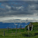
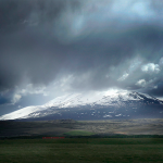
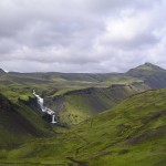
Iceland is often described, especially on travel package brochures, as the land of ice and fire. This is a decent description, but actually, as soon as you set foot on the island, you understand that this is a land where earth, wind, water, and fire are in constant fight against each other. Traveling through Iceland you can see, next to each other, glaciers, volcanoes, wind eroding mountains in front of your eyes, water cutting through the land, sea roaring against the rocky coast, lightning, rain, snow: all during the same trip. This is what we experienced, more or less, on our first trip throughout the southern part of the country, a few months ago (Pu has a beautiful photo set of the experience),
But among all natural phenomenons reshaping this land continuously, volcanoes are those that, at regular intervals, make the big headlines internationally. The reason is obvious: effects of eruptions in many of these volcanoes can lead to serious problems to the rest of the world.
Iceland has so many active volcanoes because it sits on one of the globe’s hotspots, and also on the geologic rift between the Eurasian and North American plate. This causes volcanic activity, earthquakes, and other phenomena you can see everywhere in Iceland, like geysers. The cold climate leads also to the formation of glaciers – and mixing magma with ice leads to problems like the ash cloud being scattered above Europe. Earthquakes and eruptions are rather common in Iceland; they often do not make victims among the population only because of a combination of the low density of the population (Iceland is one of the less populated countries in the world, with 3 inhabitants per km2) and an extremely well-organized emergency response program.
But because of the ash cloud, volcanoes are all the rage in these days, so I wanted to gather a bit of information about some of the top active volcanoes in Iceland. While volcanoes in Iceland are many, many more than those listed here, these famous examples show perfectly not only the power but also the variety of Iceland’s volcanic activity. The map we created lists only volcanoes discussed in this article.
NOTE: This article will remain work in progress, so check it again in the future. Last update: May 21, 2011 21:00PM.
View IcelandChronicles.com – Iceland Most Dangerous Volcanoes in a larger map
Katla
Last Eruption: 1918
Next Eruption Forecast: Scientists have been “waiting” for one since 1999
Position: South Iceland (63° 38′ N, 19° 3′ W)
 This is the biggest volcano in the current eruption’s vicinity. Everybody is fearing that the current activity at Eyjafjallajökull will lead to an eruption in this volcano. Historically, this has always been the case whenever an eruption occurred in the Eyjafjallajökull glacier. Katla is a very dangerous volcano, for many reasons. First, it is quite big. It is 1,512 meters (4,961 ft) in height, with a huge 10km crater. Second, it is partially covered by the Mýrdalsjökull glacier. Again, magma plus ice mean a lot of trouble, and floods generated by this volcano’s activity have been of epic proportions. But the scariest part of the story is that Katla erupts every 40-80 years. The last eruption occurred in 1918, and thus vulcanologist have been predicting an eruption since 1999. Funny, eh?
Links
– Katla on University of Iceland’s Website
– Katla Webcam (RUV.is)
Hekla
Last Eruption: 2000
Next Eruption Forecast: Frequent eruptions, anytime
Position: South Iceland (63° 59′ N, 19° 42′ W)
 This is the star of Iceland’s volcanoes, and one of the most famous in the world. With a height of 1,491 metres (4,892 ft), Hekla is Iceland’s most active volcano, with 20 eruptions in little more than 1100 years. Its shape, typical of all stratovolcanoes (like mount Vesuvius in Italy) but mixed with the one of crater rows, makes this beast one of the most recognizable volcanoes in the Icelandic landscape. Hekla is actually part of a 25km volcanic ridge, and two of its craters are usually the most active. The area around the volcano has low seismic activity when the volcano is not erupting – which means that as soon as stronger earthquakes are registered in the area, there are good chances the volcano is going to erupt. Last eruptions occurred in 1991 and 2000.
Links
– Hekla on Wikipedia (very good article)
– Hekla Webcam (RUV.is)
Grimsvötn, Laki, and Thórdarhyrna Volcano System
Last Eruption: 2011
Next Eruption Forecast: Frequent eruptions, dangerous also for the glacial bursts; the area is monitored constantly
Position: Highlands of Iceland (Grimsvötn lakes are at 64° 25′ N, 17° 20′ W)
These three volcanoes are part of the same volcanic fissure, with Grimsvötn at the heart of the system.
The Grimsvötn volcano lies under the lakes with the same name, which are in turn covered by the ice cap of a glacier, Vatnajökull. Grimsvötn is part of the same fissure of the Laki volcano, and its eruptions often result in dangerous glacial bursts, also known as glacier runs or jökulhlaup, where the tremendous high pressure of the melted water from the glacier is powerful enough to lift the icecap, causing huge and violent floods. The last eruptions occurred in 1998 and 2004. No glacial bursts occurred in these cases, but in the 2004 eruption the ash cloud reached Europe, and caused brief air traffic disruption in Iceland.
 Anyhow, Laki is arguably the most famous of the volcanoes in this system because of the catastrophic eruption in 1783. The terrifying event – a fissure with 130 craters opened and erupted for 8 months, hell on earth – that actually influenced this entire volcanic system (Grimsvötn kept on erupting for two years), caused death throughout Iceland and Europe. In Iceland, 25% of the population and most of the livestock died because of fluorine poisoning and famine; the period that followed the event is known as one of the most grim in the history of Iceland, the “Mist Hardships” (Móðuharðindin in Icelandic).
But the effects of the eruptions were catastrophic for all of Europe, for years. The ash cloud that spread through the continent caused sudden and crazy climate changes, with incredibly warm summers and incredibly cold winters, which led to widespread famine and poverty for years. The effects of Laki’s eruption are often seen as one of the possible causes of the French Revolution.
Links
– Grimsvötn on University of Iceland’s Website
– 1783 Eruption on Wikipedia (another good article)
Askja
Last Eruption: 1961
Next Eruption Forecast: Unknown
Position: Highlands of Iceland (65° 1′ 48″ N, 16° 45′ 0″ W)
Located in the central highlands of Iceland, it is a stratovolcano that remained largely unknown until a devastating eruption in 1875, which forced a lot of Icelanders to leave the island because of the poisonous cloud released by the volcano, which killed the livestock and made the land inhabitable. The volcano erupted again in October 1961, with an ash cloud visible from many locations in Northeastern Iceland and huge lava fountains which reached 500m in height. The smallest caldera of the volcano is filled by Öskjuvatn Lake, the deepest lake in Iceland with a depth of 217 m (712 ft). Two German researchers, Walter von Knebel and Max Rudloff, disappeared in the lake in 1907, leaving no trace. But do not be afraid, for Askja is one of the most visited volcanoes in Iceland, even though it is accessible only a few months every year, from late June to August.
To be precise, the name Askja refers to a series of calderas in the Dyngjufjöll mountains, which reaches 1,510 m (4,954 ft) in height.
Links
– Askja volcano on Mývatn Tours website
– “The Case of the Shrinking Volcano”, on Open2.net
Krafla
Last Eruption: 1961
Next Eruption Forecast: Unknown
Position: Highlands of Iceland (65° 1′ 48″ N, 16° 45′ 0″ W)
A huge caldera in Northern Iceland. The last eruption occurred in 1984. The area has been used since 1977 as source of the geotermal energy.
Westman Islands Volcanoes
Last Eruption: 1973
Next Eruption Forecast: Unknown
Position: Off the coast of South Iceland (63° 25′ N, 20° 17′ W)
This small archipelago off the south coast of Iceland is actually on top of a submarine volcanic system. Heimaey, the largest island, is inhabited by 4,000 people. The other islands are usually uninhabited. The volcanic system came to the attention of the media in 1963 and 1973.
In 1963, a submarine eruption resulted in the formation of a new island, Surtsey (which means Surtr’s island in Icelandic, Surtr being a giant in Norse mythology), which is now a UNESCO World Heritage Site, and one of the few islands with a precise known birthday: it surfaced on November 14, 1963. In the summer of 1964, the first birds and butterflies had reached the island; the next year the first vascular plants appeared, together with the first seals. To this day, the island is a unique place to study the formation of a new ecosystem. Humans are usually not allowed on the island, unless for scientific research.
In 1973, an eruption in the Eldfell volcano forced the complete evacuation of Heimaey island. The evacuation plans, which had been previously developed with great care, worked perfectly, with only one victim directly caused by the eruption. And during and after the eruption, when Heimaey was rebuilt, Icelanders gave proof of bravery and social cohesion that surprised the world.
Links
– Surtsey, Iceland on Vulkaner.no
– Eldfell eruption photos
– Eldfell 1973 eruption on Wikipedia
Hope you enjoyed the trip!
I like the picture at the top..quite interesting! 😀